Big Walnut Watershed
The Big Walnut Watershed Project
In 2017, the Big Walnut Watershed Alliance was awarded a grant to update the Watershed Management Plan to protect and improve Big Walnut and Deer Creeks in west central Indiana. The Watershed Management Plan was completed in 2020. In 2021, the Big Walnut Watershed Alliance was awarded a grant to start implementing the plan. This includes a cost-share program to put best management practices on the ground to reduce sediment, nutrients, and pathogens from making their way into the ditches and streams that feed Big Walnut Creek.
What is a watershed?
A watershed is an area of land that drains into a singular water body. These drainage boundaries are determined by land elevation rather than state or county lines, political boundaries, or residential property lines. Watersheds exist on several levels based on the size of the body of water. There are large watersheds such as the Great Lakes or the Mississippi River Watersheds. Large watersheds can be broken down based on smaller bodies of water such as the Eel River or Big Walnut Creek. These can be further broken down into subwatersheds such as Clear Creek or Eldin Ditch.
About Big Walnut Creek
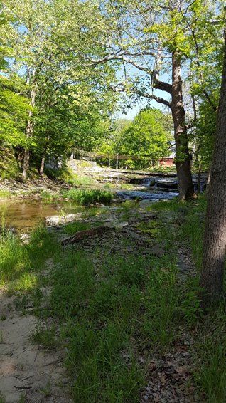
Big Walnut Creek starts in Boone County immediately south of Lebanon and flows southwesterly through northwest Hendricks County into Putnam County. Deer Creek drains the area south and east of Greencastle flowing southwest. Deer Creek empties into Mill Creek south of Interstate 70 and just before Mill Creek and Big Walnut Creek join to form the Eel River. Tributaries to Big Walnut Creek include Eldin Ditch, Ross Ditch, Tucker Ditch, Little Walnut Creek, Leatherman Creek and more.
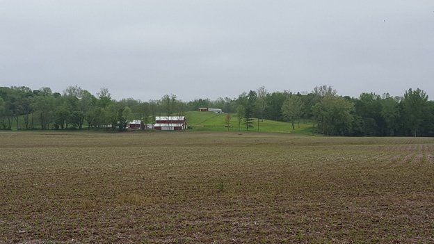
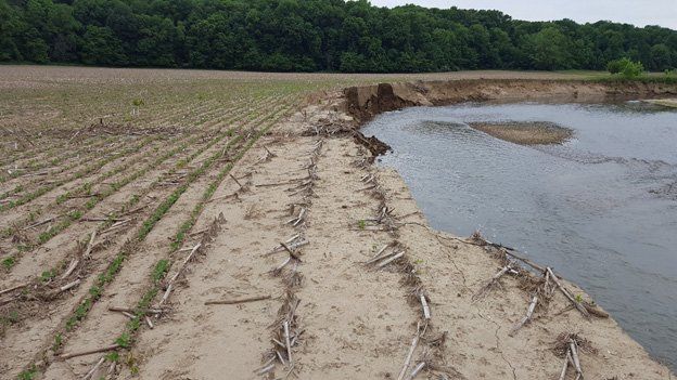
Land within the Big Walnut Watershed is a mix of forested and agricultural land uses with urban development focused around the city of Greencastle with smaller urban communities dotted across the watershed landscape. The headwaters of Big Walnut Creek are largely in agricultural production. The lower portion of the drainage contains wide forested tracts mixed with pastureland and small agricultural fields. Streams within the watershed contain elevated sediment levels with high nutrient and pathogen loads identified at select locations throughout the watershed.
About the Big Walnut Watershed Project
The Big Walnut Watershed Project focuses on protecting and improving water quality in Big Walnut and Deer Creeks. The original Watershed Management Plan was completed in 2009 with an initial implementation grant from 2009 to 2012. With updated requirements from the Indiana Department of Environmental Management, an update to the original plan was required to secure additional implementation funding. This update to the original plan was completed in 2020 and included water sampling and redesignation of critical areas. In the update, the critical areas were determined by the areas where water sampling revealed elevated levels of nutrients, sediment and E. coli. An EPA 319 Implementation Grant was awarded and started in late 2021 to implement the plan. This latest grant includes a cost-share program that funds up to 75% of the cost of approved best management practices in the critical areas.
Big Walnut Watershed Cost Share Program
The Big Walnut Watershed Project has cost share funding available for eligible conservation practices implementation within the Big Walnut Creek Watershed (link to ag and urban bifolds). Landowners in watershed funding areas (green areas) are eligible to apply for cost share funding to implement best management practices which will reduce nitrogen, phosphorus, sediment and pathogen in runoff. Approved applicants will receive up to 75% of the installation cost.
Practices must be installed according to NRCS standards and must be approved by the Big Walnut Creek Steering Committee in advance of implementation. Practices installed in advance of submitting an application, receiving approval and signing a project contract are not eligible for cost share funds. All funds are provided on a reimbursement basis. Applications are accepted on a rolling basis - all applications received by the 1st of each month are reviewed and approved during the month of application.
Have questions about the cost share program or are interested in applying? Contact
your local conservation district (link to postcard or include jpeg of front with contact details)!
Funding Areas Map- To be eligible for cost share funding, your proposed project area must be located 50% or more within the green area.